Sir Francis Drake's Nova Albion
Documenting a missing chapter in British Columbia history
by Samuel Bawlf
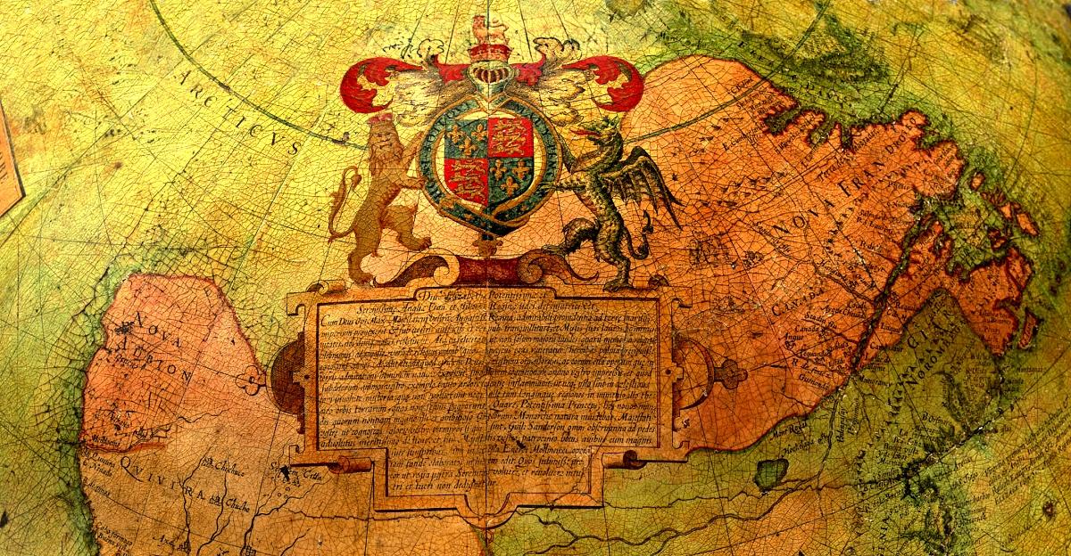
Figure 1. Detail of future Canada on the Molyneux globe.
Photos courtesy of the Masters and Benchers of the Middle Temple.
|
A 400 year old English globe provides irrefutable proof that the great Elizabethan seaman-adventurer Francis Drake explored and claimed the British Columbia coast for Queen Elizabeth I in the year 1579—two centuries earlier than the first Europeans were previously believed to have reached this coast. The globe, made by contemporary cartographer and instrument-maker Emery Molyneux,1 depicts Drake's epic voyage around the world in 1577-80 and contains information that so closely matches the actual British Columbia coastline that it could only have been based on Drake's firsthand observations of the coast. The Proof On the globe, the track of Drake's voyage reaches northward on the Pacific coast of North America to latitude 48ºN, where there is a large and distinctive indentation in the coastline. Adjacent to this feature, Nova Albion, meaning New England, is inscribed straddling the 50th parallel of latitude. Below, Drake's name is inscribed in Latin. (Figure 2) Because Molyneux's detail is drawn at a small scale, it shows only the general trend of the coast. But anyone who has studied a modern map of this coast will easily recognize that this large indentation closely matches the mainland coast behind Vancouver Island. One need only imagine what the modern map would look like with Vancouver Island removed, and they will get essentially the same picture as one sees on this globe. (Figure 3) | 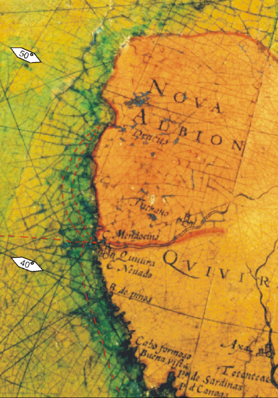
|
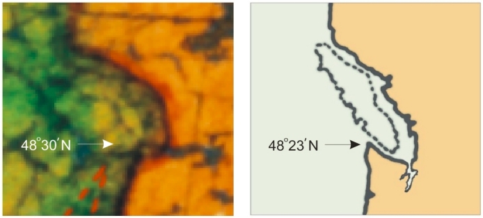
Figure 3.
Molyneux's Globe omits Drake's Island of Nova Albion |
Modern Map with Vancouver Island dotted in. |
|
The point where Molyneux's coastline turns eastward is plotted almost precisely at the latitude of Cape Flattery—48º 23'N—which marks the entrance to the Strait of Juan de Fuca. To the east, his coastline dips southward, indicating the entrance to Puget Sound, and then it runs northward to 49º before curving and running northwest, just as the mainland coast behind Vancouver Island does from that point. Clearly these readily identifiable details could not have been a figment of Molyneux's imagination. It would be impossible for such accurate details of this coast to be depicted on his globe except as a result of direct observation of the coastline by someone who was equipped to determine its latitude and compass bearing. Even if one knew nothing of the reason for the obviously deliberate omission of Vancouver Island from the globe, there is no other viable explanation: for Molyneux to have these details of the mainland coast that is hidden behind Vancouver Island, Drake had to have sailed through the straits which separate Vancouver Island from the mainland. Thus, the globe provides incontrovertible proof and a priceless record of Drake's exploration of British Columbia's coast in the year 1579. Corroborating Evidence The information on Molyneux's globe is corroborated by a large body of evidence that I assembled in an investigation that I undertook in 1996—2000. In my research I examined all of the known contemporary sources pertaining to Drake's voyage into the North Pacific. In the course of this study, I was able to decipher and unravel a veil of state secrecy imposed by Elizabeth's officials to conceal from England's rival, Spain, Drake's discovery of what he believed to be the Pacific outlet of the Northwest Passage, and his choice of Vancouver Island to become Nova Albion—the New England which was to serve as the base for English maritime enterprise in the Pacific once discovery of the Passage was complete. In 2001 I published this research in Sir Francis Drake's Secret Voyage to the Northwest Coast of America, A.D. 1579 (hardcover, 160 pages, 45 maps and illustrations. ISBN 0-9688528-0-7). 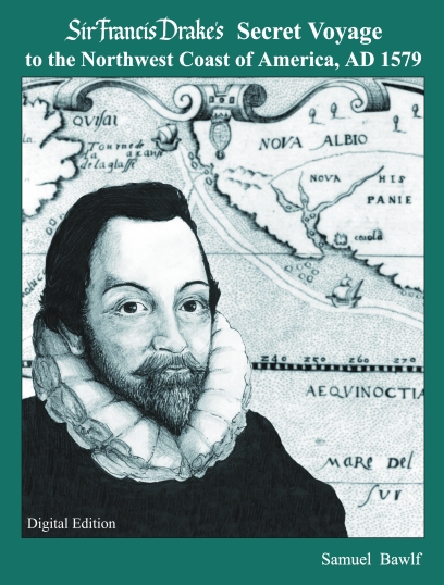 Comments By Leading Scholars Richard Ruggles, Emeritus Professor of Geography, Queen’s University, and one of Canada’s foremost authorities on the mapping of discoveries:
“I really believe that his approach is correct. He has done really solid research. It changed my whole approach to understanding [the subject]… I had the opinion that Drake had gone to 48 degrees and Nova Albion was in California. I am now convinced that Drake travelled to southeast Alaska and Nova Albion is on Vancouver Island.”2
|
Updated July 2018